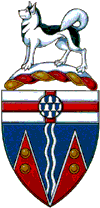
Yukon Territory


 Yukon Territory and it's counties are available to be hosted. Please contact me if you are interested in hosting this site.


Yukon Territory, administrative region of NW Canada, bounded on the North by the Beaufort Sea, on the East by Northwest Territories, on the South by British Columbia and Alaska, and on the West by Alaska. The Mackenzie Mountains forms much of the Eastern boundary. Yukon Territory entered the Canadian Confederation on June 13, 1898. Yukon Territory remains a land which is sparsely settled, having vast amounts of mineral wealth. It remains one of the great wilderness regions of North America. The name of the territory is taken from the Yukon River; the word coming from an Indian word meaning "great river."


Yukon Territory Places

Carcross Carmacks Dawson City Faro
Haines Junction Marsh Lake Old Crow Teslin
Watson Lake Whitehorse    


Yukon Territory Facts:

Capital: Whitehorse
Floral Emblem: Fireweed
Area: 186,300 sq. mi; includes 1730 sq. mi. of inland waters; 8th largest among the provinces and territories.
Highest Point: Mt. Logan 19,524 ft.
Lowest Point: Sea level, along the Arctic Ocean
Principal Rivers: Yukon, Peel, Pelly, Stewart, Porcupine, Liara
Principal Lakes: Kluane, Aishihik, Kusawa, Teslin


AHGP | AHGP Canada


 Add/Correct a Link

  Comments/Submit Data


Copyright 2005-2015 by Canadian Genealogy
The WebPages may be linked to but shall not be reproduced on another site without
written permission.